A commercial property can look clear on paper. The deed gives a description. The title report lists what sits on record. The land itself can still hold surprises.
An ALTA title survey is built for a moment like a commercial purchase. People sometimes think of it as a map, but a map is only part of what it does. The survey shows how a property’s physical features line up with the rights and records tied to it. For a buyer, that link is what counts.
A title search reads records. It looks at deeds, liens, easements and other recorded interests. An ALTA title survey goes out to the site and shows how those recorded items relate to what’s actually there. One checks the record. The other checks the ground against it.
Turning the Purchase Agreement Into a Physical Property Check
A purchase agreement and title report describe a property in words and legal terms. They don’t always show what a buyer would see standing on the lot. An ALTA title survey turns that written description into a drawing of real conditions.
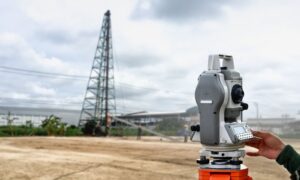
The surveyor compares the recorded description with what’s on the ground. Fences, buildings, parking lots and driveways get drawn in place. These built features are what surveyors call improvements. The buyer can then see how the parcel and its structures fit together.
That view helps during a commercial deal. Commercial properties come in many forms. Some are tight urban lots in a downtown block. Others are large parcels with wide open areas near the edge of town. A clear picture of the land helps a buyer study either one before money changes hands.
Following the Property’s Edges Beyond the Deed Description
A deed describes where a property’s edges should be. An ALTA title survey shows how those edges relate to the things around them. That part is useful for a buyer.
The survey marks the boundary lines. It also shows easements, which are rights that let someone else use part of the land. A power company might hold one for its lines. A neighbor might hold one for a shared driveway. The survey shows where these sit.
Access is another point. The drawing shows how a buyer can legally reach the property from a public road. It also flags buildings or other features that sit close to a property line or an easement. A wall that crosses a line, a shed near an easement, a driveway that runs onto the next parcel, these are things a buyer wants to catch early.
These details matter because future plans depend on them. A buyer who wants to add a building or more parking needs to know what the edges and rights allow.
Seeing Physical Conditions That Matter to Title Review
Some property conditions never show up in recorded documents. They only appear when someone goes out and looks. This is where an ALTA title survey adds something a title search alone can miss.
Encroachment is a good example. That’s when a structure crosses onto land it shouldn’t, like a neighbor’s fence sitting a few feet inside the boundary. Records might say nothing about it. The survey shows it.
The survey also shows easements and other rights as they appear on the ground. A title professional can then compare the recorded interests with what the surveyor found. When the two don’t match, that gap deserves a closer look before the deal moves ahead.
It helps to be clear about what the survey does and doesn’t do. It doesn’t clear title. It doesn’t promise title insurance coverage. It supplies information. Current ALTA/NSPS standards focus on this kind of information, the conditions a survey and site visit can reveal that public records may not show. A title insurer can weigh that against the record.
Giving the Commercial Team One Survey Document to Work From
A commercial purchase pulls in a lot of people. Buyers, lenders, attorneys, title professionals, architects, engineers and developers may all touch the deal. An ALTA title survey gives them one drawing to read together.
Each party uses it for a different reason. A lender checks the property backing the loan. An attorney reviews rights and possible conflicts. An engineer and architect study the site before design work. A developer looks at what the land can hold. They’re all reading the same conditions instead of separate versions.
Getting there takes some agreement up front. Current ALTA/NSPS standards ask the client, lender, insurer and surveyor to talk early and settle what the survey should include. Part of that is choosing optional items, known as Table A items, that add specific details a buyer or lender wants shown. Talking it through at the start keeps everyone working from the same drawing.
Using Survey Findings Before the Purchase Becomes Final
The most useful thing a buyer can do is read the survey early. That leaves room to act on what it shows.
If the drawing shows something unexpected, say an easement in an odd spot or a possible encroachment, the buyer can bring it to the right person. Some questions go to an attorney. Some go to a title professional. Some go to an engineer. The survey points to the issue. Other professionals help decide what it means.
Sometimes a finding calls for more digging. A buyer might order more study on a boundary question or an access route. When a buyer reads the survey alongside the rest of the review, the inspections, the environmental work and the financing, all of it moves together.
Timing is the reason to start early. Commercial deals run on deadlines like anywhere else. A survey read a week before closing leaves little room to sort out a real problem. A survey read early gives the buyer time to ask, check and plan.
One point is worth being clear on. The surveyor doesn’t decide if a buyer should go through with the purchase. The survey gives facts. The choice to buy involves legal, title, financial, engineering and other judgment that sits with the buyer and their advisors.