
How To Find Your Property On FEMA’s Flood Insurance Rate Maps

What are FEMA flood maps?
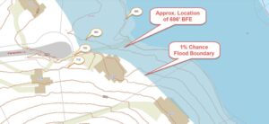
FEMA’s Flood Insurance Rate Maps (FIRMs) or just Flood Maps are provided after a flood risk assessment has been completed or updated for a community.  This study is known as a Flood Insurance Study.  The FIRM gives you the Base Flood Elevations (BFEs) and insurance risk zones in addition to floodplain boundaries.  The FIRM may also show a delineation of the regulatory floodway.

Once the “insurance risk zone”  (commonly referred to as the flood zone) is determined, actuarial rates, based on these risk zones, are then applied for newly constructed, substantially approved, and substantially damaged buildings.  FEMA uses these rates to determine the insurance rate you will pay for flood insurance

FEMA’s Digital Flood Maps

FEMA discontinued the production and distribution of paper flood maps in 2009 as part of its Digital Vision Initiative. This affected all the Flood Maps, boundary information, and study reports. However, clients can still view the products for free through their website or buy them in digital format.

To view these flood maps online, go to FEMA’s Map Service Center and key in your address (hi-lited area shown here) search for your home.  This will prompt you to then select the map that covers your area.  The Flood Maps are somewhat cumbersome to use online. It is best to go through the tutorial on the bottom right of the address search page for an easier and more effective use of the GIS map.

More Posts

Aerial view of a commercial property being reviewed for an ALTA title survey
alta survey
Surveyor

How an ALTA Title Survey Supports a Commercial Purchase

A commercial property can look clear on paper. The deed gives a description. The title report lists what sits on record. The land itself can still hold surprises. An ALTA title survey is built for a moment like a commercial purchase. People sometimes think of it as a map, but

Read More »
Surveyors conducting boundary survey fieldwork in South Dakota
boundary surveying
Surveyor

What Happens When Two Surveys Disagree on the Property Line

Two boundary surveys can show two different property lines on the same piece of ground. That does not automatically mean one surveyor got it wrong. It means something in the evidence, the records, the monuments, or how they were read, does not line up. Sorting that out takes actual investigation.

Read More »
Drone mapping a South Dakota property to compare potential subdivision layouts
drone surveying
Surveyor

How Drone Mapping Helps Plan a New Subdivision

Drone mapping gives a development team a fresh look at a piece of land before anyone draws a single lot line. In South Dakota, where a new subdivision may sit on open acreage or a growing edge of town, that early view matters. It shows what the property looks like

Read More »
Surveyor reviewing an ALTA survey plan at a commercial property in South Dakota
alta survey
Surveyor

What Table A Items You Should Add to Your ALTA Survey 

An ALTA/NSPS Land Title Survey comes with a list of 21 optional items called Table A. These items add extra work and detail beyond the base survey. Picking the right ones for a property takes some thought. Picking the wrong ones wastes money or leaves out data a lender needs.

Read More »
Surveyor locating a property line marker during a boundary survey in South Dakota
boundary surveying
Surveyor

What a Boundary Survey Actually Includes and Leaves Out

A boundary survey tells you where your property lines sit. That part is simple. What confuses most people is everything around that line: what the surveyor checked before drawing it, what shows up on the final map, and what the survey does not touch at all. The Evidence Behind the

Read More »
Topo survey showing South Dakota property terrain, contour lines, drainage areas, and elevation change
land surveying
Surveyor

What a Topo Survey Actually Shows You

Most people picture a topo survey as a stack of squiggly lines on a map. That’s part of it. But the real value sits in what those lines and marks tell you about a piece of ground before anyone breaks it. If you’re buying, building, or planning work on land,

Read More »